A drive-up on quite good gravel roads (see below), with great views in all directions (fully logged following forest fire a few years ago).
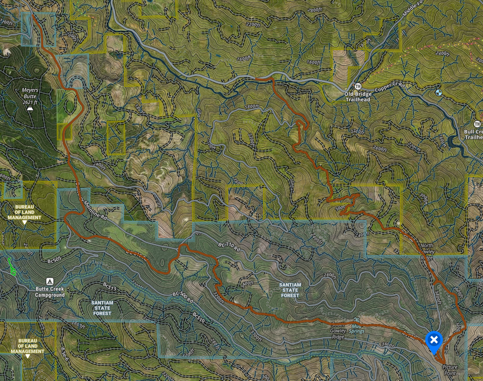
I came in from the West, leaving the paved road at 44.97599, -122.50586. These subsequent gravel roads were good enough for any passenger car. Just watch for big rocks on the road. There's not much to say about this road. There were very few gates, and I didn't notice any signage near them (unlike below).
After the activation (there was good 2m access to the PDX area) I decided to try to get out another way, toward the Table Rock trailhead to the North -- HOWEVER this route is NOT Priasuable northbound, and doesn't appear to be Rav4able southbound. Doing so required me to pass through several gates (e.g. one between Santiam State Forest and BLM land), all of which were open, and all of which (I suspect) are open during spring and fall (let me know if you discover something different and I'll update this blog). At least one of them is probably closed in Summer (it had a sign that said "closed for wildfire" or some such), and signage near another seemed to imply that it might be closed in the winter, but this is just a guess. This latter route to the North joins (or leaves) the paved road on the way to the Table Rock summit at this location: 44.96254, -122.43951.
Here are both routes: