
Summit
Trail Characteristics
APRS Coverage
Don't know
Cellular Provider
Verizon
Voice Cellular Coverage
Good, very usable
Data Cellular Coverage
Good, very usable
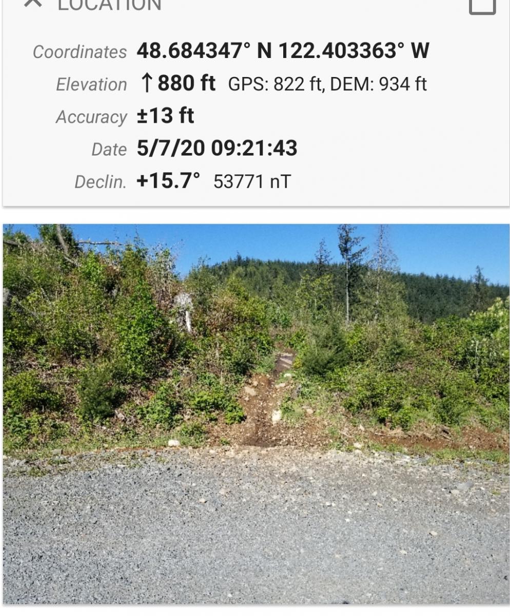
This is an easy hike half on a good road and half by trail. The area is also used by mountain bikes. There is limited parking at the gate at location 48.688594 N, 122.403296 W, although few use this trail system. Follow the well maintained road .6 miles until the place on the right side of the road where the trail begins. See Picture.:
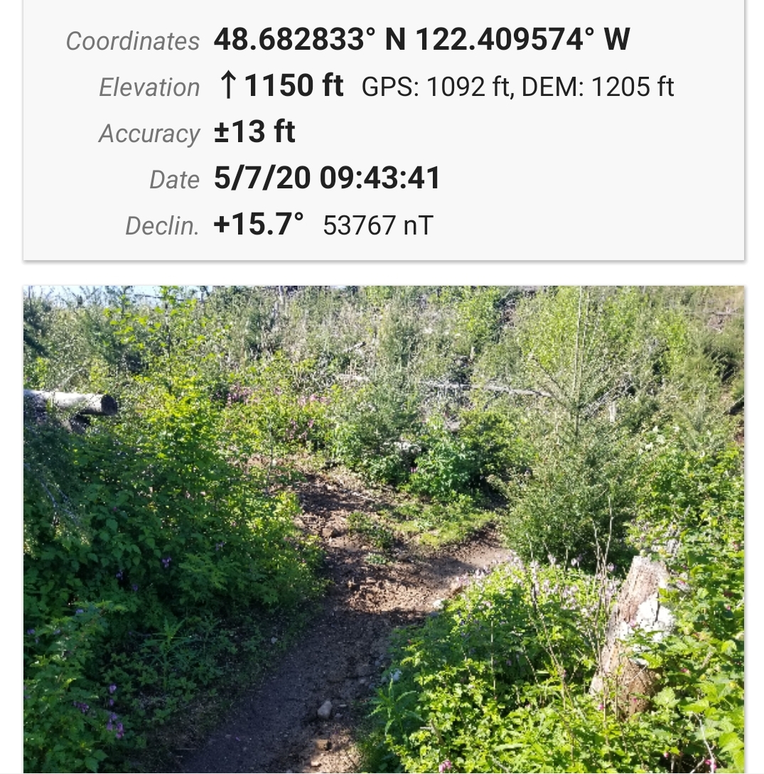
Follow the trail, visible on Google Earth, for about 0.3 miles and find where there is a fork in the trail to the left. See picture:
Follow this short trail to the road that will lead to the summit. My activation was in the activation zone short of the summit away from the radio towers wth a great view overlooking Lake Samish.
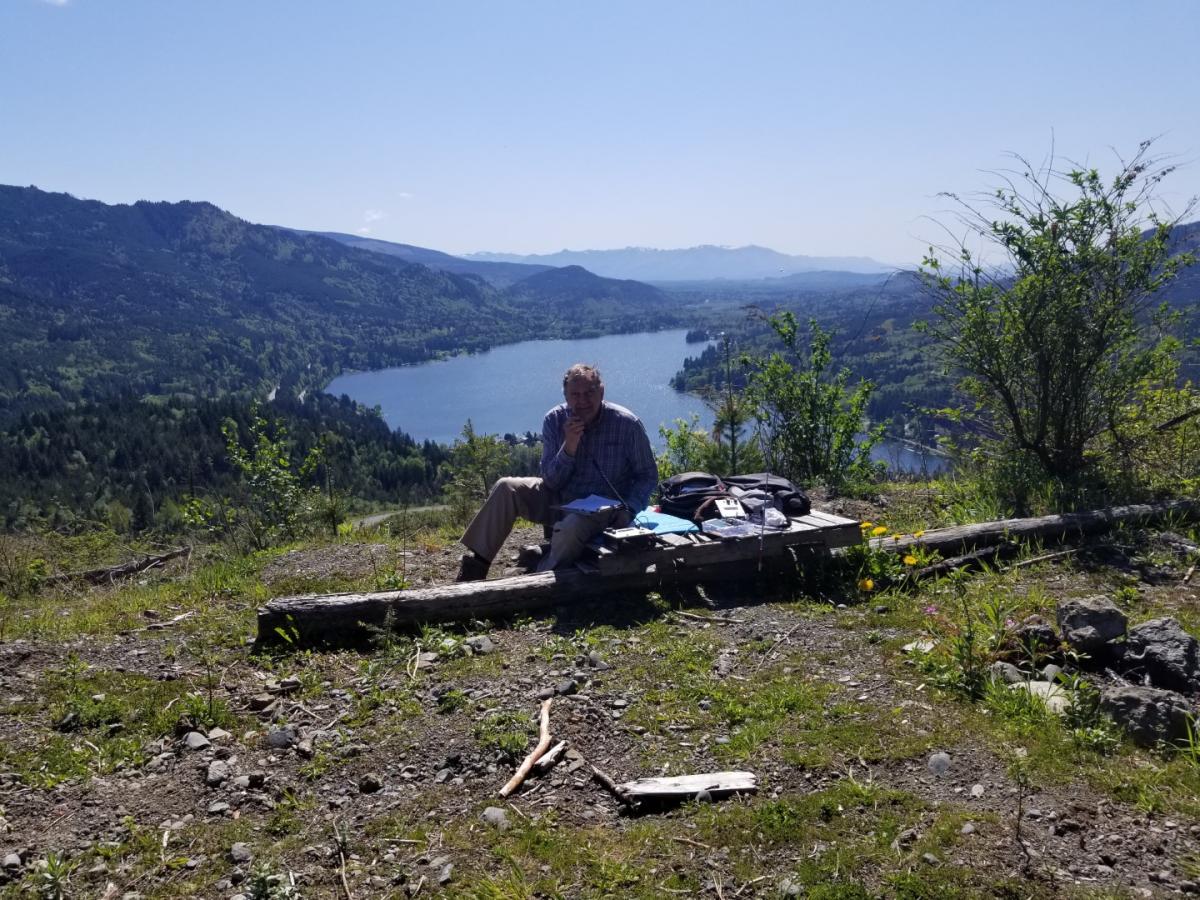
73 Dan KA7GPP