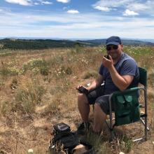
Spanish Peak is a rough road to a gorgeous 360 view of the Ochoco National Forest and John Day valley. The last half mile to the summit is especially white knuckle as you drive up a road barely wide enough for you car with a steep drop off to the left. But once you're there, the view is amazing! You'll drive past and above the radio tower to the remnants of an old fire lookout. There's plenty of space to park and turn around on the top. Very few trees up there and some steep drop offs, especially to the North. This drive-up summit could easily be combined with another drive-up to the South, Wolf Mountain.
From the town of Mitchell, Oregon
Take Hwy 26 East for about 12.5 miles
Turn Right/South on Buck Point Rd
Continue on Buck Point Rd for aprox. 7 miles
Turn Left/East on NF 12 (Summit Rd)
Continue on NF 12 for aprox 8 miles
Note: at about 6 miles you’ll pass Cottonwood Campground, a no fee campground with a spring and pit toilets. This would make a good jumping off point if you wanted to attempt multiple summits in a day (Spanish Peak and Wolf Mountain).
Turn Left/East on FR1250
Continue on FR1250 for 3.5 miles
Turn Left on NF38 (Arvid Nelson Rd)
Continue for aprox. 5 miles
Turn Left/North onto FR 200
Note: This is a large intersection. Turning Right/South here onto FR3820 will take you to Wolf Mountain.
Continue up FR 200 for aprox 5 miles to the summit. For the next 5 miles the road is extremely rough and rutted. High clearance vehicle recommended. We made it in a Toyota Highlander, but just barely in a few spots. We didn’t need to engage all wheel drive, but in wetter conditions, you might.
Note: at about 3.5 miles you’ll pass a trailhead. Turning Right and following the road/trail around to the left will get you to a dead-end camping site with a spring behind it.


