Summit
Keywords
Trail Characteristics
APRS Coverage
Don't know
Cellular Provider
Verizon
Voice Cellular Coverage
Don't know
Data Cellular Coverage
Decent, workable
Follow any road map to Soda Mt. Rd or Hobart Bluff TH off of Hwy 66. You will follow the gravel road down past Hobart Bluff Trailhead, there is a parking area and restroom here. Go on past the trailhead aways until you reach the gated driveway for Soda Mountain on the right. It is a 1.5 mile walk up to the summit using the road. Minimal parking area as you will be in wilderness and there is very few pullouts to park in.
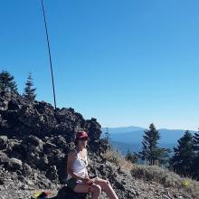
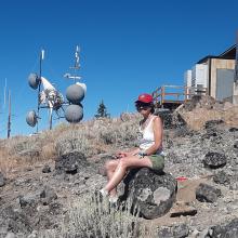
The summit has ample equipment on top but the view of N. CA, Pilot Rock and Shasta are to die for. It is at an angle and direction I am not sure you will find anywhere else. Exposed summit with plenty of space and rock to set up at.
de AG7GP


