Another highly recommended hike and activation - this one in the Clackamas River drainage. The trailhead is about 90 minutes from Portland and the round trip hike is 6.2 miles with 2000 feet of elevation gain - getting you great views from a lovely summit.
From Estacada take 224 east about 20.5 miles to NF-4620 that leads to Indian Henry Campground. This is just before a bridge that crosses the Clackamas River.
Proceed 7.8 miles starting on a paved road that turns to well-graded gravel after about five miles. Near 7.2 miles you'll pass a road heading off to the left and at 7.8 miles a second left turn that is blocked by piles of dirt where you may notice a road marker with "22" (indicating that NF-4620 turns into NF-4622). The trailhead is very near 45.0527, -122.1195. Trailhead parking is here at this blocked "left turn." The somewhat obscure trail here leads up steeply and you'll see a trail sign after a short distance confirming you've found the place.
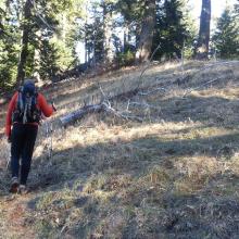
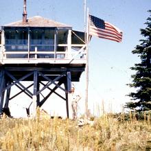
From here it's a good climb with switchbacks on a mostly well-graded trail until you reach an old roadbed. Turn up the roadbed (right) and watch for where the road appears to split into two - take neither but look for the trail continuing on the ridge between the two roads (see the photo). The summit will eventually be reached and you'll find there foundations of the former lookout and good views to the west and south. Trees have grown up on the side facing Mt. Hood - good views of that peak can be found down the trail a bit.
We were told that bears and cougars are not uncommon around this peak but we saw no wildlife on this trip. For more information see also www.portlandhikers.org/forum/viewtopic.php?f=8&t=16185 and www.trailadvocate.org/?page_id=55.
Here's a story from the fire lookouts in 1945: https://www.trailadvocate.org/wp-content/uploads/2010/09/Our-Cabin-in-the-Sky-final-.pdf.


