A PCT SOTA Summit
West Twin Butte, WA | Sept 2019

Summit
WW7D and I were in the area for the WA State QSO party (Salmon Run). This was the 2nd summit we did on this extremely wet Sunday in late Sept.
The road up to West Twin Butte is really fun... if you are on a motorcycle! The last 1/2 mile of this road is heavily rutted out, and would be a challenge for a high-clearence 4x4. Most people will probably opt to park lower down and walk up the road.
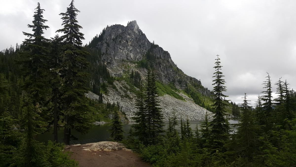
Lichtenberg Mountain

Summit
I started from the Smithbrook Trail #1590 off of NFS Road #6700 which is just east of Steven's Pass on Hwy 2.
The trail goes up 1 mile to a junction with the Pacific Crest Trail. Turn left (Southbound) onto the PCT, continue about 2 miles and turn left down the Lake Valhalla access trail.
Potato Hill, WA - June 2019

Summit
My son and I did this activation. The starting point for our hike was the intersection of FR 5603 and the Pacific Crest Trail. We parked at this location and started walking down the PCT which was adjacent. We found no trail to the summit so we started bush whacking. It was not too hard. After about an hour, we made the summit.
McDonald Peak, Oregon

Summit
Poor McDonald, like Rodney Dangerfield, it gets no respect. And honestly, that’s not fair. Sitting in line with the heralded Mt. Ashland (W7O/CS-019), McDonald is easy to access, has a great operating position, and spectacular views of the Siskiyous in all directions. If you are activating Mt. Ashland, you absolutely must make it a double if the roads are open and clear.
Birkenfeld Mtn, WA | September 2015

Summit
Birkenfeld Mountain is a summit that can be done as part of a challenging three peak traverse that would include Three Corner Rock-W7W/LC-101 and Greenleaf Peak-W7W/LC-104. Or Three Corner and Birkenfeld and back the way you came - those two summits make for a 10 mile day.
Peak 4620, OR (Blue Box Summit) | February 2017
Summit
Peak 4620 (near Blue Box Pass) is a backcountry snowshoe activation that can be done in the winter if you don't mind using a GPS and are comfortable with off-trail navigation. It's about 1.7 miles one way and 700 feet gain.
Three Corner Rock, WA | November 2016
Summit
This is a fine hike that many should try at some point - it's 4.4 RT miles and 800 feet of gain for the 'short' version described here, with a summit pinnacle that makes for a fun scramble if you feel the need to get to the tippy top.
UPDATE February 2021 - The "Three Corner Rock Trail" is closed - however, the directions below don't use that trail. It's much longer: https://www.alltrails.com/trail/us/washington/three-corner-rock-trail.
Miller Mountain, Sept 9, 2016

Summit
In the last few years, I've developed a desire to activate the top 10 summits in the
Willamette Valley region. Miller Mountain is in that list but I've put it off because
its so far from the valley. Its located in south-central Oregon, closest to the town
of Chemult. I guess the placement algorithm treated it like a lost sock that you can't
throw away but you're not sure where to put it.
My approach to Miller Mt. was to take US Hwy 97 south towards Chemult, Oregon. About
0.5 mile north of Chemult, FS 9772 heads west. This road is also marked "Walt Haring
Mt Thielsen activation, 8.31.2016
Summit
Cruising through Chemult Oregon at 6:40am, the dashboard said the outside temperature
was 29 degrees. This was far cooler than we anticipated for our attempt on Mt. Thielsen.
A few years ago, my son Andrew and I tried this summit but were driven off by mosquitoes
and our lack of DEET. I actually inhaled two of the beasts and slapped my glasses off my
face several times before we literally ran back to the safety of our car. The Diamond Lake
area is legendary for mosquitoes.
This morning was different. It was a brisk 36 degrees at the Mt. Thielsen trailhead. Seeing