
Peak 4816, OR | August 2017

Submitted by K7ATN on
Summit

Peak 4816 is a near drive-up summit a bit east of Mount Hood, accessed mostly on paved Forest Service roads. The summit area has an small but interesting rock pinnacle. You should consider this summit in the Mount Hood 2m FM "dead zone" as we were not able to raise anyone on 146.52 except a sked with a nearby S2S. Also, APRS and cell service were marginal or non-existent, so that spotting our activations on HF were a real problem.
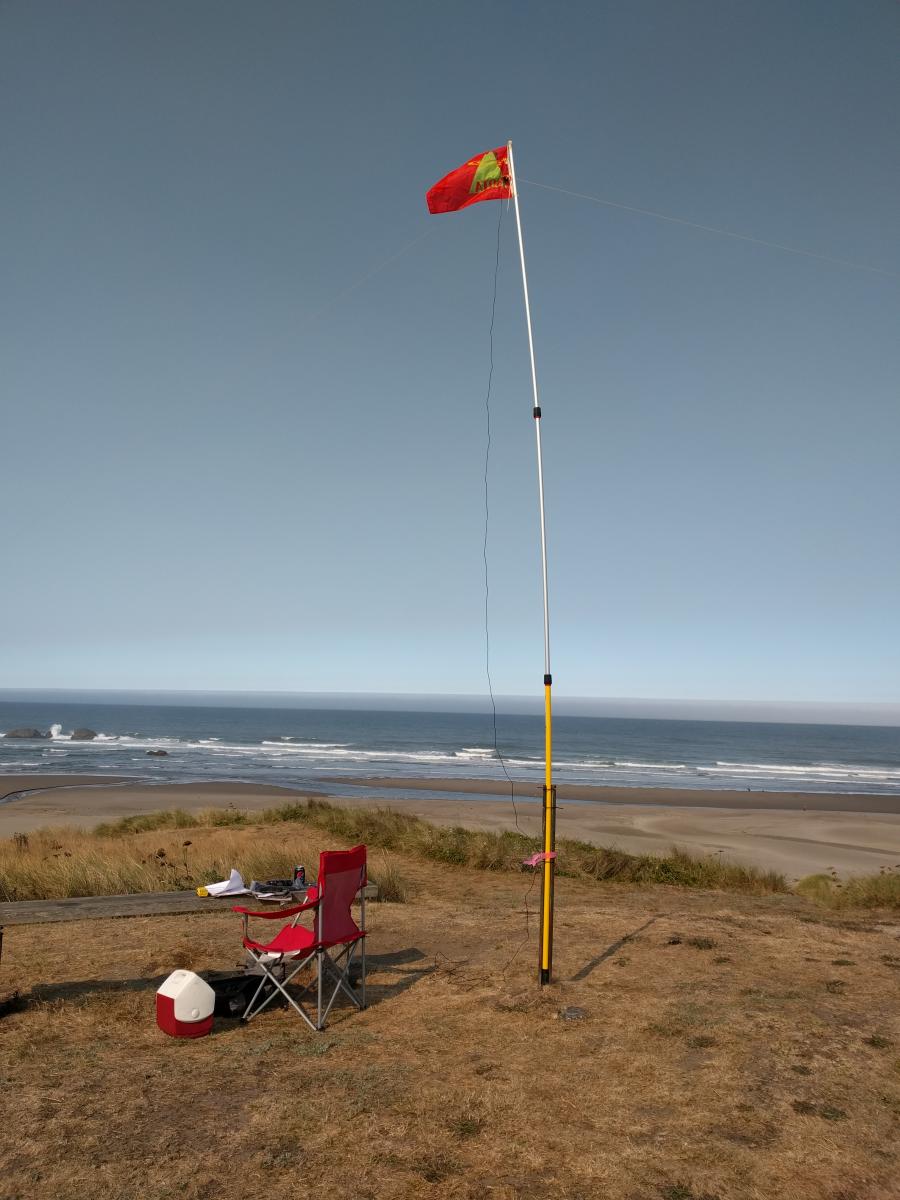
Peavine Mountain, OR | August 2017

Submitted by K7ATN on
Summit

Peavine Mountain is a drive-up summit a bit east of Mount Hood, accessed mostly on paved Forest Service roads. You should consider this summit in the Mount Hood 2m FM "dead zone" as we were not able to raise anyone on 146.52, even after begging on the Mt. Hood repeater. Also, APRS and cell service were marginal or non-existent, so that spotting was a problem. 

Cedar Butte, Oregon / August 2017

Submitted by KI7EMX on
Summit

Travel on Highway 6, and turn north onto Cedar Butte Road between milepost 17 and 18. Drive over the bridge and continue straight at the Muesial Creek Road junction (0.1 mile). There are signs at each junction that direct you to the Cedar Butte Trailhead, however, mark your mileage here and watch for posted signs. The trailhead is about 5.5 miles from this point, although the sign says 5.7. At 2.0 miles turn right at the “Y” intersection. At 4.8 miles, the Cedar Butte Road veers left. Continue another 0.7 mile to the trailhead.

Humbug Mountain, OR | August 2017 - Temporarily Closed

Submitted by K7ATN on
Summit

This summit is north of Highway 26 on the way to the coast from Portland.

In August 2017 Lewis & Clark Timberlands has posted the road to Humbug Mountain "Land closed to public entry due to high fire danger."

It had been open to foot traffic before summer and it was open in January 2018 - see trip report here.. 

10K Chaser Points

Submitted by WA7SB on

After nearly two years of less than dedicated seat time I was able to collect my 10,000 SOTA chaser points.  This is my 2nd set of 10K points.  The first being when I operated and chased as WA6RIC.  Moving to Oregon some three years ago, I gave up my W6 callsign for a W7.  I then made the decision to start chasing again in W7O land.  However, I soon found out that my QTH is not in the best location.  Being on the coast (Newport) I have the hills and the Coastal Ranges backing up to me.  That and low sunspots and generally bad band conditio

Grindstone Mountain

Submitted by KI7EMX on
Summit

This summit had never been activated and I now know why!  The USGS maps would have you believe there is a road to the summit.  There actually was a road when the forestry lookout was standing, but the last 1-1/2 miles of road is now overgrown and would take some guts and a great off-road 4-wheeler to traverse it.  These same last miles are steep and unrelenting, though completely forested.  When the so-called road ends. there are a few hundred feet of vertical trail required to reach the summt.

Scar Mountain, Oregon, KF7SEY

Submitted by KF7SEY on
Summit

Scar Moutain is a old lookout site. No trail to the summit which required some bush wacking. Start by taking Parish Road off of Highyway 22 east of Detroit at 44°31'31.88"N 121°59'40.09"W. Follow this for about 2.25 miles. Turn right onto NF-1164 at 44°31'19.71"N 122° 1'49.04"W for about 2.5 miles. Then turn left on NF-1161 at 44°33'2.95"N 122° 2'38.65"W. Follow this for 4 miles. Turn left at 44°33'56.79"N 122° 6'26.54"W. The peak is on your left. After I went left I parked on a wide spot on the road less then a quarter mile in.